
Top 12 Most Dangerous Passes in Vietnam You Should Know (P.1)
Although considered as dangerous roads, the obsession of long-distance drivers, but the passes in Vietnam always attract visitors by their wild and magnificent beauty.
Are you someone who likes to explore new things or conquer tough terrain challenges? Then you definitely cannot ignore the most beautiful and the most dangerous passes in Vietnam. Along with tourist resorts, the dangerous passes are always something that always attracts Vietnamese people. If you like to learn new things, like to experience and conquer, immediately add these most dangerous passes in Vietnam to your backpacking list.
Passes in Vietnam: Ma Pi Leng Pass (Ha Giang)
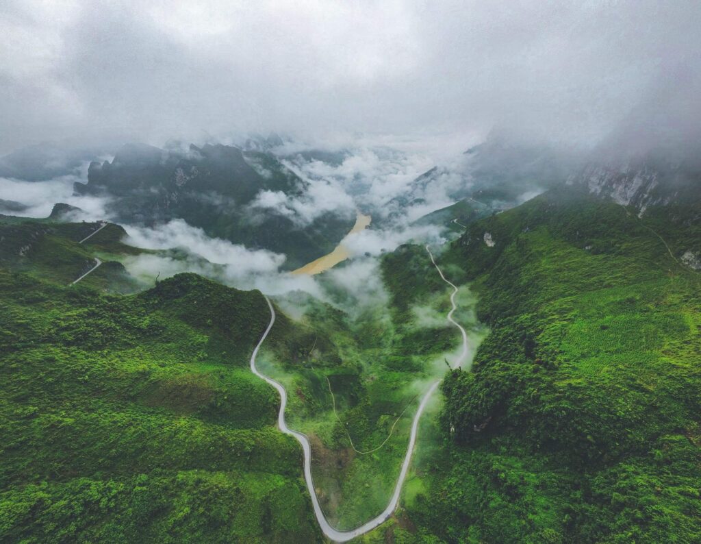
Ma Pi Leng Pass is a pass road about 20km long, located on the Hanh Phuc road connecting Ha Giang city to Dong Van, Meo Vac. More than 1200m above sea level, Ma Pi Leng is like a winding silk strip, gliding along the mountainside with deep abysses, which is a great challenge for those who love adventure travel. From afar, the pass looks like it’s split in two, one side is the top of Ma Pi Leng, the other is Sam Pun (Sam Pun) – where there is a border marker and the border gate to Dien Bong, China.
Ma Pi Leng in Quan Hoa language means “the bridge of the horse’s nose” literally. Its figurative meaning describes the craziness of the top of the mountain, where the slope is so high that the horse has to die, or the peak is as steep as the bridge of a horse’s nose. Ma Pi Leng Pass, unlike other passes in Vietnam, is not long but is the most dangerous road in the northern mountains, and is likened to the “king” of Vietnamese passes.
Contrary to the majestic beauty, is the danger that always lurks for the driver at every turn. Fog, narrow zigzag roads plus sleeve bends make it very difficult for vehicles going in the opposite direction to avoid each other.
To make this road, tens of thousands of workers from all over the Northern provinces worked hard day and night chiseling stones to make the road for 11 months. The pass road was initially opened for pedestrians and lorries only, later expanded to accommodate rough vehicles, but it was still very dangerous because of the bends. After completion, Ma Pi Leng pass has 9 bends along the steep cliffs, below is the abyss.
With rugged terrain and spectacular unspoiled landscape, Ma Pi Leng pass on Ha Giang plateau is one of the four great peaks of the Northwest mountains.
Explore More: Cat Ba National Park – The Complete Travel Guide [Updated 2025]
Pha Din Pass (Son La – Dien Bien)
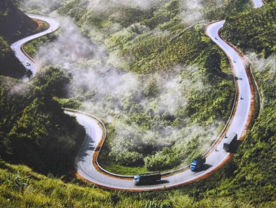
Pha Din Pass, also known as Pha Din slope, connects the two provinces of Son La – Dien Bien. This pass was famous during the Dien Bien Phu campaign because it suffered thousands of tons of bombs and still survived. The name Pha Din pass comes from the Thai ethnic language “Pha Din”, in which Pha means heaven, Din means earth, implying here is the confluence between heaven and earth.
Looking down from the top of the pass, Pha Din has a very dangerous and precarious terrain, a thin road crisscrossing between a cliff on one side and a deep abyss on the other. The slope of the pass is about 10%, in some places 12% to 15%, even there are local uphill bends of 19%.
This is one of the most challenging passes in Vietnam. When going uphill and downhill, the long zigzag road with 8 extremely dangerous races, the radius of the curve is less than 15m and besides, there are countless sleeve bends, A and Z turns in which there are many curves. Many sections are just enough for one car to pass. A dangerous factor of Pha Din is that it is located on red soil mountains, not limestone mountains like other famous roads, so the ground is relatively weak, prone to landslides in the rainy season.
In 2005, the government decided to invest in upgrading the National Highway 6 in the Northwest. In which, the section Son La – Tuan Giao was built from 2006 to 2009 and completed, dividing Pha Din pass into two old and new routes on the fork of the pass. The old Pha Din pass is 32km long (from km 360 to km 392 located on the old national highway 6), has the highest point of 1648 m above sea level and about 125 famous dangerous bends, narrow roads, many sections are just enough. let a car pass. The new Pha Din Pass was built along the mountainside to the left of the old National Highway 6, the length is reduced to 26km with about 60 bends, some bends are up to 60m wide, the slope is reduced to 8%, especially the road surface is 2 times wider than before.
Since the new Pha Din pass route has been put into use, it has made traffic safer, while the old Pha Din pass is only suitable for locals or adventurous tourists to like to conquer famous passes in Vietnam.
Discover Related Guides: Top 3 Best Internet Service Providers in Vietnam you should know
O Quy Ho Pass (Lai Chau)
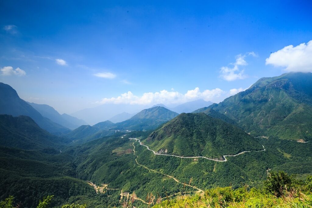
O Quy Ho Pass has a long zigzag road on Highway 4B. Of which, 2/3 of the distance is in Tam Duong and Lai Chau districts, the remaining 1/3 is in Sa Pa and Lao Cai. This is probably one of the passes in Vietnam that holds the record for length with a length of up to nearly 50km. The top of O Quy Ho pass in the middle of the mountains is also known as the Heaven Gate.
When winter comes, the top of O Quy Ho pass can be covered with snow and ice. O Quy Ho Pass is also known as Hoang Lien Son Pass or May Pass, crossing the Hoang Lien Son range.
This pass route is now well upgraded, becoming a more frequent traffic route. However, with one side being a deep abyss and the other side being a steep cliff, the pass is winding and winding, up and down continuously according to the concordance of the mountain range, this famous pass will make the pass bikers have tough moments. It only takes a second of carelessness and both people and vehicles will plunge into the abyss below.
To ensure safety, it is best to go by motorbike or car during the day, do not go at night when visibility is limited, and always keep a moderate speed to handle all possible accidents from happening.
Khau Pha Pass (Yen Bai)

Khau Pha Pass is located on Highway 32, with the starting point being the section of Highway 32 with National Highway 279 with a length of over 30km. It belongs to the bordering area between Van Chan and Mu Cang Chai districts, Yen Bai province and passes through many other famous landmarks such as: La Pan Tan, Tu Le, Che Nha, Nam Co… When traveling from the city Yen Bai reverse along Highway 32 for about 5 hours through Tu Le commune, Khau Pha pass, Mu Cang Chai district, you will see a plateau surrounded by mountains.
Because it is located at an altitude of more than 1200m above sea level, the temperature is quite low, so the top of Khau Pha pass is often cloudy. The pass road is dangerous, winding, crisscrossing mountains.
Khau Pha Pass is one of the most winding and steep passes in Vietnam, crossing the top of Khau Pha mountain, the highest mountain in the Mu Cang Chai region.
During the length of the pass, there are dozens of bends. On cloudy days, Khau Pha Pass becomes extremely dangerous for drivers because visibility is limited. Add to that the danger lurking from the rocks from the high mountains that can fall in bad weather conditions.
Related Guides: Toiletries In Vietnam And a Guide On Where To Find Them
Ma Phuc Pass (Cao Bang)
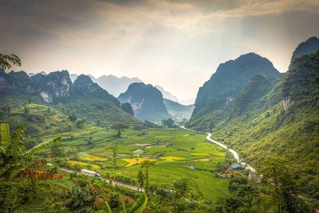
Visitors to Cao Bang, if they want to visit Ban Gioc waterfall, Nguom Ngao cave (Chong Khanh district) or visit Ta Lung international border gate (Phuc Hoa district), visit the prosperous town of Quang Uyen (Quang Uyen district). .. must go through Ma Phuc Pass.
The pass is about 20km east of Cao Bang city, in the territory of Quoc Toan commune, Tra Linh district. Although the pass is quite dangerous, there are many beautiful scenes. Ma Phuc Pass is about 3.5km long; about 700m above sea level. It meanders along the limestone mountainside.
From the foot of the pass to the top of the pass, there are 7 steep slopes. On one side of the pass is a towering cliff, on the other is a deep abyss with narrow ravines. Ma Phuc Pass is a unique road, the gateway to the eastern districts of Cao Bang province.
Although Ma Phuc Pass is not as dangerous as other passes in Vietnam, it also makes people who are not familiar with this road also afraid in the first time passing.
Thung Khe Pass (Hoa Binh)
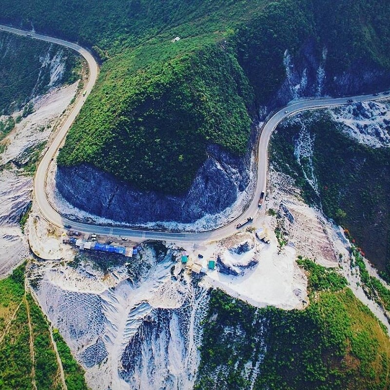
Thung Khe Pass belongs to Highway 6, Hoa Binh province, located between Tan Lac and Mai Chau. Reach the middle of Thung Khe pass at an altitude of 1000m above sea level. There are several rows of thatched-roof shops here, which are tables assembled from rough trees on the side of the road. They sell sugar cane, rice lam, rock moss, forest vegetables. You can stop to enjoy boiled corn, boiled sugarcane, eat extremely attractive rice with sesame.
The pass is not as majestic or steep as other passes in Vietnam, but Thung Khe contains countless unexpected dangers for any rider.
Explore More About Vietnam: Sending and Receiving Mail and Parcels Abroad from Vietnam
Thung Khe Pass does not have the bends of the sleeve like the pass roads in Ha Giang or Lai Chau, Dien Bien, but it is dangerous because of the dense fog every afternoon, whether it is winter or summer. Passing Thung Khe Pass in the winter evening is an unforgettable experience for any driver, with thick fog and numbing cold, cloudy vision, only the lights of the car and the moon light if you’re lucky enough…


